North Carolina Triple Crown
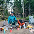
This is the first time I have ever written something of any significant meaning to myself and others who like to punish their body significantly. Covid has inspired me to explore the natural world more than ever before. When I found out that I would have the opportunity to spend my winter break in Western North Carolina after a challenging semester at Colorado State University, I knew I had to challenge myself physically and mentally. The two weeks before I returned home, I spent every waking moment, not at work or at school, planning what I have come to title the North Carolina Triple Crown (NCTC). The North Carolina Triple Crown consists of three trail runs totaling close to 100 miles. Growing up in Asheville, North Carolina, I had an idea of all three locations I wanted to run.
The first of these would be a route that I had completed when I was working at Camp Celo in Burnsville, North Carolina, two years ago, on a day off. The original hike I did was 25 miles linking together trails that follow the J that the Black Mountains make — coming out of the valley in Burnsville on the Black Mountain Crest Trail, which follows the ridgeline to Mount Mitchell, the highest peak east of the Mississippi. I modified the 25-mile hike to make it 35 miles after arriving in Asheville and doing a training run on a section of the Mountain-to-Sea-Trail. I recognized the ability to link the original 25-mile loop nearly back into Asheville, making it a 35-mile alternate Black Mountain J hike, arriving at the trailhead at 4:45 in the morning.
I started up the five-mile climb to the ridge via the Black Mountain Crest Trail in complete darkness. The sense of being in the woods with the only light around being that of your headlamp is one of the sensations I crave most; you feel alone in your little bubble of light.
Traversing the ridgeline, I reached the parking lot at mount Mitchell to find it was empty, and the canteen at Mount Mitchell State Park picnic area was boarded up for the season. I was out of the water and needed to take a s***. I relieved myself, filled up on water, and continued on my way down Mount Mitchell, via the Buncombe Horse Trail. Crossing over Highway 128, I continued up to Potato Knob and then down until crossing the Blue Ridge Parkway and where I left the original trail that I had completed two years ago. Entering new territory on the Mountain-to-Sea-Trail, I stripped off my long sleeve base layer and pulled out a Clif bar sandwich for lunch. Hitting Walker Knob, Locust Knob, and crossing over the Blue Ridge Parkway a couple of different times, bagging peaks all along the way.
I ran into my friend Ben’s little brother as he was hiking with some of his friends, and they asked what I was doing. I replied calmly, “Out for a 35-mile run,” this didn’t register with them. I finally came across a trickle of water coming off a rock and filled my water bottles using my Befree Katadyn water filter. I descended into Rattlesnake Lodge and then dropped a lot of vertical into Bull Gap, entering familiar territory on the Mountain-to-Sea-Trail. I surprised myself by running the last two and a half miles back to the parking area at Craven Gap Trailhead, where my parents had generously left a car for me to drive back into Asheville. To say the least, I was haggard. I mean, really fucking haggard. This was the longest distance I’d ever covered in one day and the fastest: I completed the trial run in 11 hours 47 minutes of total moving time with 10,400+ feet of vertical ascent. I was hooked.
The second hike I tackled was the Art Loeb Trail, a 30.1-mile trail that runs from Camp Daniel Boone to the Davidson Campground. I spent weeks of my life at the northern starting point that is Camp Daniel Boone, a Boy Scout camp where I spent one week a summer working on requirements to achieve my Eagle Scout badge. It was another early 5 am start that begins with an ascent to the base of Cold Mountain through Shining Rock Wilderness.
As I climbed out of the valley that Camp Daniel Boone sits, I found the ground getting harder as it was frozen, the wind picking up and the temperature dropping and reaching the base of Cold Mountain. I was still surrounded by darkness as I reached the ridgeline that I would traverse through Shining Rock Wilderness. I reached the ridgeline, and per wilderness area guidelines, there were no trail markings and or blazes leading me in the southern direction I needed to hold. I saw reflective guy-wires of a tent in the direction I needed to head in but being 5:30 in the morning, and I moved around the cleared out area at the base of a Cold Mountain in the early morning darkness, searching for the trail. Finally, having confirmed that the route could only be where the tents had been located, which was no more than five feet off the trail, I passed through their camp. So much for a wilderness area. Climbing the ridgeline, I found myself surrounded by trees covered in ice crystals. It was cold, beautiful, and invigorating all in the same instance.
I continued on the ridgeline until daybreak, when I stripped off my rain jacket and tried to pick up my pace. That didn’t work out well as the trail was ice-covered, and I was slipping, not what you want on a solo attempt to run 30.1 miles. The ridge’s views are some of the most beautiful long views I think North Carolina has to offer.
I found the rest of the Shining Rock Wilderness to be pretty much empty. The ice hindered my pace for the first 15 miles of the day until I commenced the descent off the ridgeline and started towards Davidson River Campground. Crossing the Blueridge parkway after descending off the ridgeline was a monumental part of my day. After spending years of my childhood exploring the valley that Bevard sits at the end of and the Blue Ridge sitting at the other end, I knew the rest of my day I would focus on reaching the Davidson River Campground.
This second part of my day would be hiking through a valley I have countless memories of backpacking, climbing, and leading trips. I was moving faster than I had on the Black Mountain J Alternative run. I was on track to go sub ten hours, which was a significant improvement on my almost 12 hour time of the weekend before. I was moving well and decided I would push it. I came into the Art Loeb trailhead in 9 hours 23 mins covering 8700+ feet of vertical ascent. I was pretty wrecked, but I had enjoyed the day smiling to myself and recalling lyrics of “How Lucky” by Kurt Vile and John Prine- “How lucky can one man get?”
My last adventure of the North Carolina Triple Crown would be a circumnavigation of Linville Gorge. There was a Backpacker magazine article a couple of years ago that my dad and I found to give some context to this hike. Being naive, we thought that it would be a great idea to attempt a 22-mile two-night backpacking trip after only a couple of other backpacking trips together. We had both spent time in the woods, and I had begun to understand my love for the natural world and my need to connect to it. As neither of us had experienced the gorge, we failed to realize how technical and changeling this incredible place can be. To make a long story short, we far underestimated our abilities to navigate, trek, and be in such a rugged space. After years of visiting the gorge climbing, hiking, backpacking, and most recently leading 11–12-year-olds through this landscape, I felt I was ready to tackle the loop again. This time, I was going to add about 8 miles to the original Linville Gorge Wilderness Loop to explore the northern part of the gorge for which I had never explored before. This hike would also be different as I wanted to bring a friend along this time. A lifelong friend and true adventuring friend willing to blindly follow me on any absurd activity my mind dreams up. Ben wasn’t ready this time for what he referred to as “Not fun, not fun at all, but maybe character growth.” It was a pleasure to experience such a day with my friend. We started in the dark as usual at the Table Rock Picnic Area, heading down towards Hawksbill. We encountered our first navigation misstep when we mistook the trail in the dark and ended up on a “trail” that most people who have spent any time in the gorge can tell you are commonplace. These “trails” consist of pretty much a bushwhacked path that sometimes connects to something or sometimes dead-end in a pile of brush. That was precisely where we found ourselves. After a couple of hundred feet of descent, Ben asked if we were still on the trail. Checking the map via GPS, it was evident that we were not on any trail, but we could link up to the Spence Ridge trail to get us back on track. With a little bushwhacking, we were back on track, but not for long as we were walking through the dark with the only illumination coming from our headlamps. We passed a none existent trail off of Spence Ridge that would have taken us by Hawksbills’ base on our way to Sitting Bear mountain. We ended up on a Table Rock road and decided that we weren’t going to test our luck anymore in the dark and decided we would walk on the road and then cut in at Sitting Bear mountain to continue our journey north up the gorge. We overshot the trail as it was no more than a game trail through the woods that linked up to trails on the far side of a Sitting Bear.
The trails north of Sitting Bear were all questionable, but to say the least, we had learned our lesson and were sure to check the map at every trail intersection and verify we were still on track. This paid off as we started to descend into the gorge to the river, where we crossed the river to connect to the Linville Gorge trail, where we spent most of the rest of the day.
We made steady progress down the gorge descending as the river drops towards Lake James. Just after the crossing at Spence ridge, we ran into an unlikely group that we both knew well. Our old Boy Scout troop was on a backpacking trip in which we both earned the highest rank: Eagle Scout. We got to say hello and talk maps before we were on our way again. Our pace was slowed by what was explained to me from Ben as a ball burning sensation created by horrible chafing.
We made our way down and reached the crossing that would take us across the river and up Shortoff mountain on our way back towards the Table Rock Picnic area. There were 4,400 feet of vertical gain between us and the end of our day. That was a lot to ask for Ben, who had been holding his balls Michael Jackson style for hours at this point. We crossed the river soaking our feet for the second time, and started our journey back to the car. It was slow-moving up Shortoff mountain, but our view got better every 40 steps that we took. That’s how we moved for the last 8 miles, 40 to 80 steps at a time. We summited Shortoff mountain and got rewarded with a long view of the North Carolina mountains and Lake James. We carried on as the light started to leave the sky, switching to headlamps as our light source nearing ever closer to our final destination. Just over 12 hours later, with 8,800 feet of vertical gain, we found ourselves back at the car in the dark. This journey was the cumulation of years of dreaming about seeing the most gorge in one day, making it a trip I will never forget.
This idea to run/hike/walk/sludge through the woods taught me lessons about what my body is capable of completing. It showed me this in two ways: planning and then over planning is the best way to go about moving long distances through wild places, and physically it showed me that if I set my mind to something, I will want to finish it. Being back in North Carolina has been a grounding experience. The mountains that I grew up in have the power to center your thoughts, but also, that might be the hours I had to explore my headspace walking through them.